
April 25, 2026
VisionQuest /
CountingCoup 2026
Tale of Two Summits
Registration is CLOSED
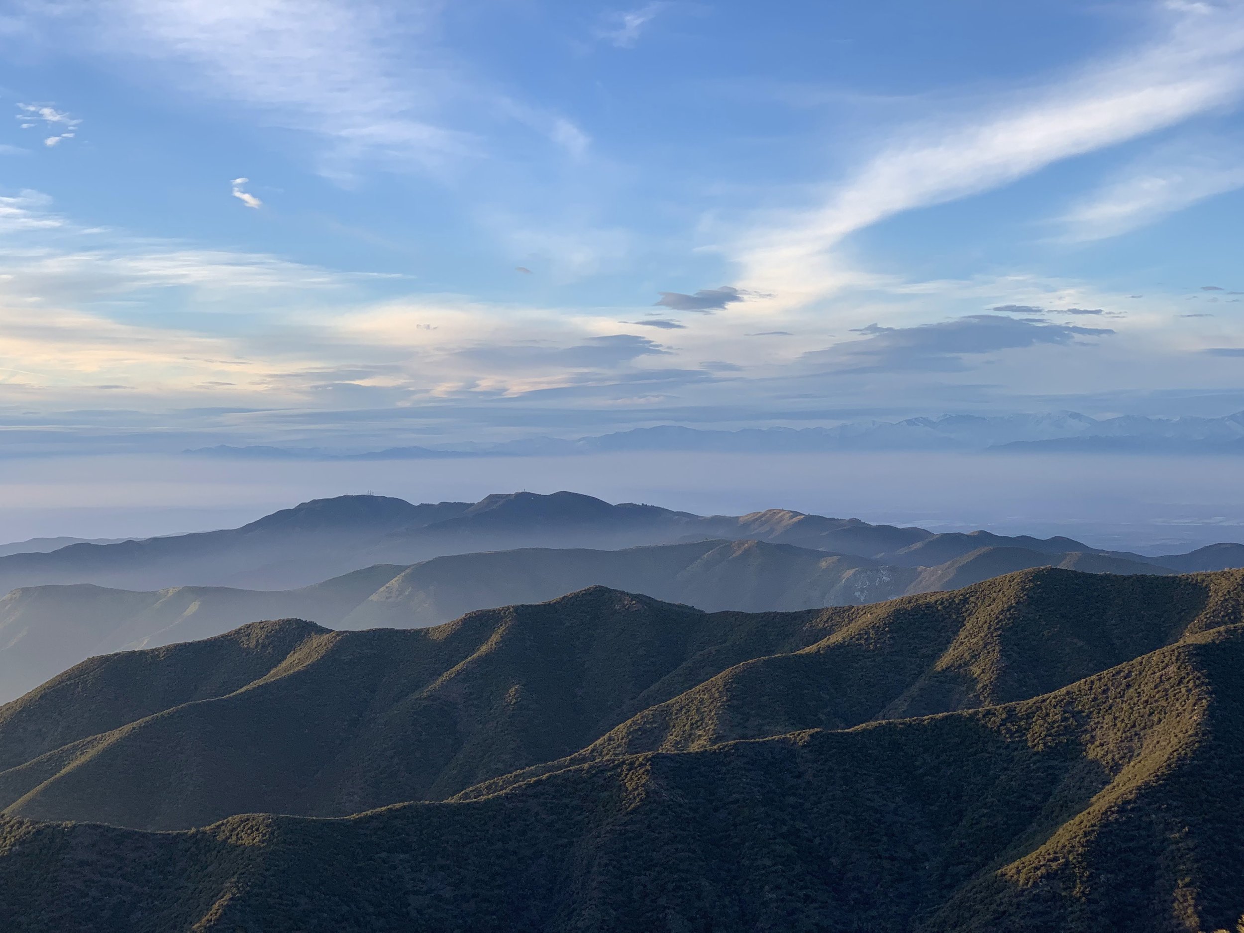
This year’s VisionQuest is April 25, 2026. The theme is “The Tale of Two Summits” as we’ll stand atop both Modjeska and Santiago Peaks!
What happened to the old route (Modjeska Peak, Pleasant’s Peak, Two Monkeys and Tombstone)?
We originally published and promoted a different route involving Modjeska Peak, Pleasant's Peak, Tombstone and Two Monkeys. The route has since changed to include Modjeska and Santiago Peaks, excluding unsanctioned trails (Tombstone, Two Monkeys, Buckthorn). This was done in an attempt to comply with Forest Service permit requirements (no unsanctioned trails). Unfortunately, after communicating the course change we learned we still cannot get a permit because we are using an unofficial trail to access Eagle Road. Because we cannot get a permit for this course, we had to make the event free. Any revenue-generating event requires a permit, but our event can't get one because our course can't get approval. While we could revert back to the original course, we feel that this would cause further confusion and also be frowned upon by the Forest Service. Note no law prohibits the use of unsanctioned trails.
-
Just blood, sweat and, hopefully not any tears. Truly, it is free!
-
Registration is closed
-
Maybe! We need a crew of e-bikers to help act as support for the event. This includes acting as a sweep, on trail repair person or first responder in case of emergency. This means you are responsible for the safety of the participants and you might not be able to ride the entire course if an accident occurs. You would be required to attend an in-person training.
Reach out if you are interested in fulfilling this duty.
-
VQ cut off will be a little over halfway through the course, at the mile 29 (6000’ gain) aid station after Pleasant’s Peak. This is the same place CC riders would turn around to go down Motorway, so if you miss the cut-off time, you are doing the CC route. This will likely be 6 hours. Cut off for CC: use your best judgement at the Motorway-Main Divide intersection.
-
There will be one aid station about halfway through the course. Count on only water and hydration powder. The aid station will bring your specific supplies/lunch that you drop off in the morning.
-
You need enough to ride more than half the course (29mi, 6000’).
-
Yes, if you don’t have a bell, you can’t ride. Seriously, avoid ruining your ride day and get a loud bell that won’t fall off, like The TIMBER Bolt-On Bell right now.
-
Motorway is popular as heck with hikers. A bell helps prevent collisions.
-
Our most technical terrain, a blue or blue-black singletrack with 2000’ of vertical descent, comes at the end of the course. This is Maple Springs Trail aka Motorway.
-
All good rides have a hike a bike.
-
Registration is closed
-
Yes! The first half of the VQ and CC are shared so you can fall back to the CC if you can’t complete the VQ or miss the cut off time.
-
See the donation page for the long answer.
-
We originally published and promoted a different route involving Modjeska Peak, Pleasant's Peak, Tombstone and Two Monkeys. The route has since changed to include Modjeska and Santiago Peaks, excluding unsanctioned trails (Tombstone, Two Monkeys, Buckthorn). This was done in an attempt to comply with Forest Service permit requirements (no unsanctioned trails). Unfortunately, after communicating the course change we learned we still cannot get a permit because we are using an unofficial trail to access Eagle Road. Because we cannot get a permit for this course, we had to make the event free. Any revenue-generating event requires a permit, but our event can't get one because our course can't get approval. While we could revert back to the original course, we feel that this would cause further confusion and also be frowned upon by the Forest Service. Truthfully, no law prohibits the use of unsanctioned trails. I expect many riders will still do Buckthorn and Old Main Divide despite those trails not being on our official published course.
Descending Modjeska Peak.
VisionQuest
Approximately 50mi/9.5k vertical
Tons of mountainous terrain finishing on a 2000’ singletrack descent (Motorway)
Two Awesome Summits: Modjeska Peak and Santiago Peak
CountingCoup
Three options varying from 25 to 37 miles, 5-7000’ vertical
A lot of mountainous terrain finishing on a 2000’ singletrack descent (Motorway)
Summit Modjeska and Santiago Peaks, if you want—or don’t.
A (Two Summits 37mi/7k): https://ridewithgps.com/routes/54118921
B (One Summit 31mi/6k): https://ridewithgps.com/routes/54118935
C (No Summit 26mi/5k): https://ridewithgps.com/routes/54118944
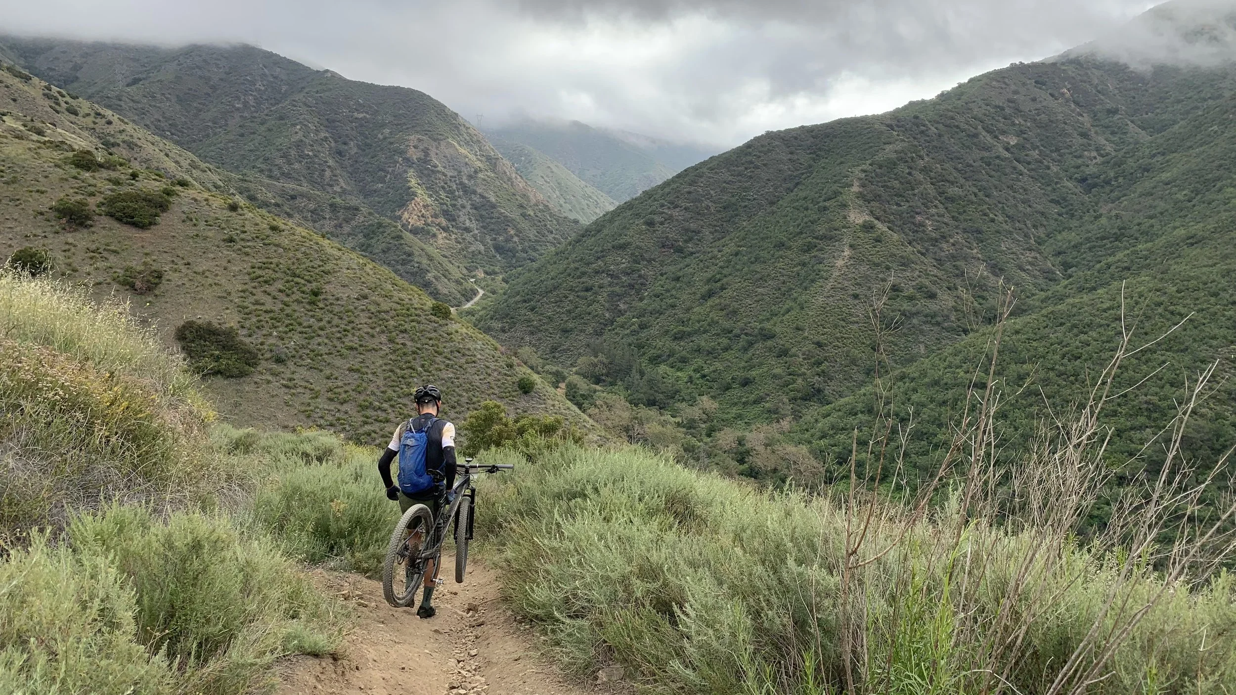
An injured rider walking down Motorway