
Trail Map - with BOLT and Proposed
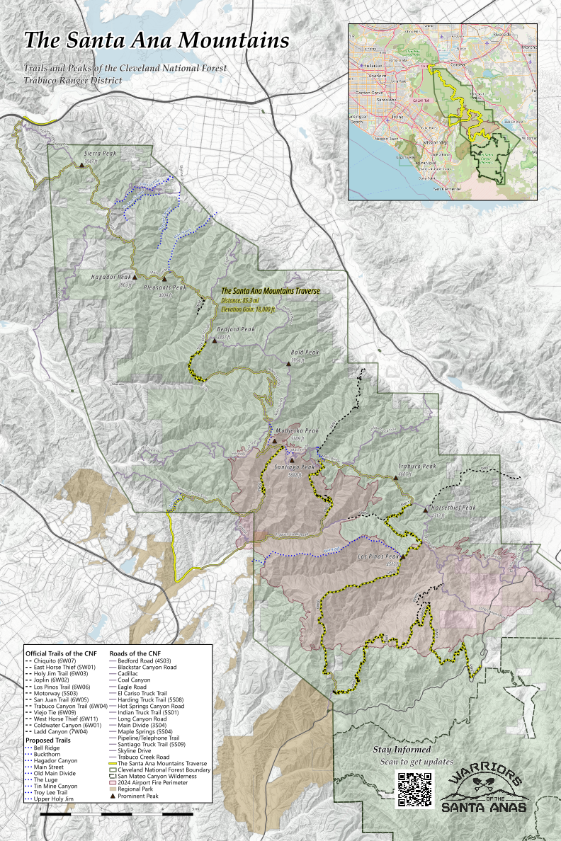
This is a map of the Cleveland National Forest, Trabuco Ranger District. It includes the official trails and fire roads of the CNF TRD. It also includes some unofficial trails that we think should be part of the CNF TRD trail inventory. Additionally, our BOLT route submission is featured in yellow. This is an 85 mile link-up of nearly all the CNF trails. We call it The Santa Anas Traverse.
Latest Map
The updated latest version includes three additional trails, federal land-ownership shading, all the major OC regional trail parks areas, San Mateo Canyon Wilderness boundary, and an improved base map using topographical lines.
This latest version is available for a small donation.
Donate using the button below, then send me a message—I’ll send you the map. The donation supports our work in the Santa Anas.
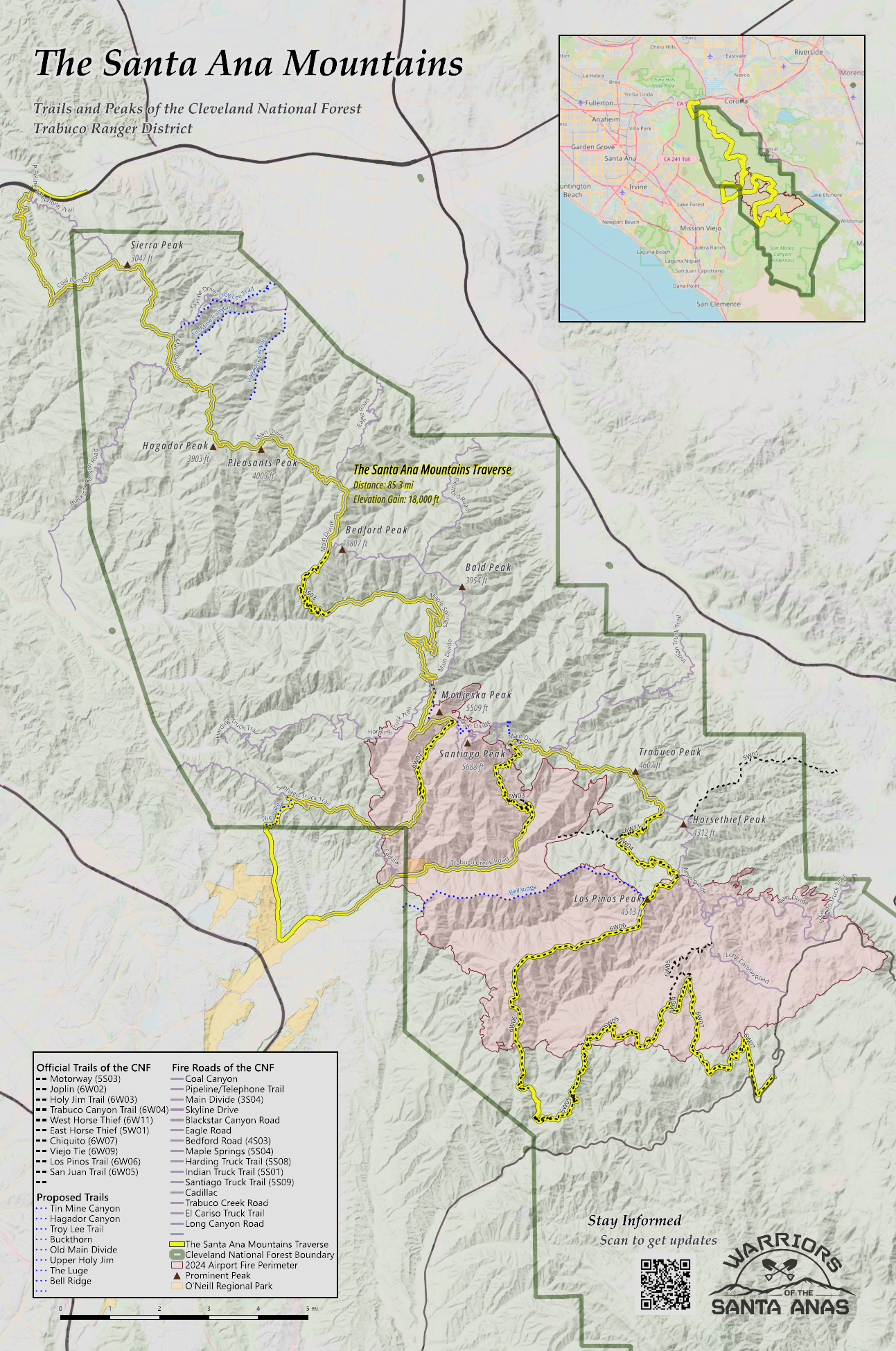
Free Map - Original Version
The first version of this map is available for free. This is the version I printed and presented at the OCMTBA Trail Festival. It’s great but it is missing three trails and federal land designation shading in the improved version above.
Official CNF TRD Maps
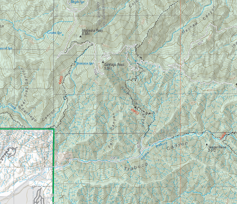
This is an official map from the Forest Service’s Digital Maps website.
The Ranger District map is the most detailed map that shows the entire district. Scale: 1:63k
If you need even higher scale maps, check out FS Topo series. Scale: 1:24k