
Ride Invite, Trail Proposals, Airport Fire Rehab Update
In this newsletter, we invite you back to Maple Springs for another ride and cleanup, celebrate a major trail-proposal milestone, share an update on the broader Airport Fire rehabilitation effort, and remind you to speak up for our roadless backcountry.
Modjeska/Motorway Loop Ride + Four Corners Cleanup
Next Saturday September 19, we invite you to join us for the same epic route we rode a few weeks ago. It seems the litter has already reappeared at Four Corners, so we’ll use this as just another opportunity to get together, enjoy the mountains, and leave the forest better than we found it. If you missed the last ride, this is another chance to join the fun.
As before, we’ll climb Maple Springs Road, stop at Four Corners for a quick cleanup, continue to Modjeska Peak, then descend Buckthorn and Motorway together. Check out the instagram reel from last ride to see what to expect.
There are multiple ways to join and the hardest descents are all optional:
Full ride (5h): 20 miles / 4500’ – Four Corners, Modjeska Peak, Buckthorn and Motorway
Medium ride (4h): 18 miles / 3500’ – Four Corners, Modjeska Peak, Buckthorn and return
Short ride (3h): 14.5 miles / 2700’ – Four Corners and return
Shuttle option: 4 miles / 1000’ – for those who want to help, summit Modjeska and descend Buckthorn, but don’t want to pedal all the way up Maple Springs Road
Pedalers: Meet at 6:30AM at the dirt lot at the bottom of Motorway, beyond the Forest Service gate. Roll at 6:45AM.
Shuttlers: Meet at 7:30AM. Drive up at 7:45AM.
RSVP by replying to this e-mail or through the Facebook event
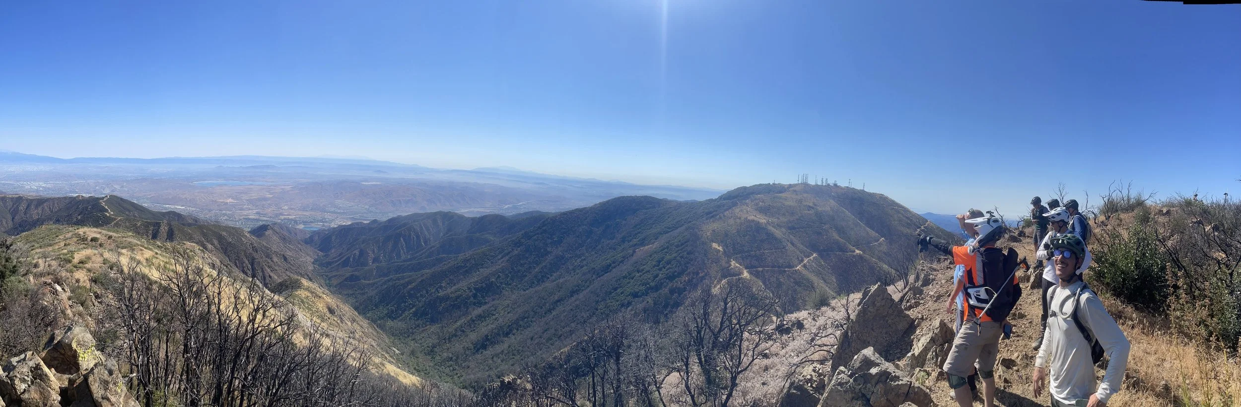
The crew on Modjeska Peak’s summit after picking up trash.
Trail Proposals Submitted for Forest Service Review
Back in March, we introduced an effort to pursue formal recognition for several established and historic trails in the Trabuco Ranger District that are not currently designated as National Forest System trails. Since then, Jason Bennett has spearheaded the project, bringing together proposals from Warriors of Santa Anas and CoronaMTB. This week, after months of research and coordination, Jason submitted the trail proposals to the Forest Service for review.
The proposals include route maps, trail histories, proposed uses and adopters, maintenance needs, land-status information, and initial environmental-review materials. If approved, these routes could be added to the official trail inventory and maintained through the Adopt-a-Trail program.
These are only proposals and the Forest Service has not provided a timeline for review. To expedite approval and reduce adoption costs, we structured the proposals for consideration under a categorical exclusion. This is a streamlined NEPA pathway that can avoid a more extensive environmental assessment or environmental impact study.
The 11 trails are organized into four proposal packages:
Legacy Trails: The Luge (Morrow Trail), Bell Ridge, Upper Holy Jim, Buckthorn, and Old Main Divide. The Jennings/Bennett stewardship group is the proposed adopter for The Luge; Warriors of the Santa Anas proposes to adopt the other four.
Skyline Corridor: Main Street Ridge and Diablo (Bagel Bites), with CoronaMTB as the proposed adopter.
Troy Lee Corridor: Troy Lee and Paul’s Fall (Upper Shorter Stuff), with CoronaMTB as the proposed adopter.
Hagador + Tin Mine: Hagador Canyon and Tin Mine Canyon, with CoronaMTB as the proposed adopter.
Jason deserves tremendous credit for driving and coordinating this project. Additionally, thank you to Jason Fitzgibbon, a local wildlife biologist, who helped us understand the environmental considerations and to OCMTBA for supporting the project. This is a strong example of how much we can accomplish by working together.
This effort is another iron in the fire and an investment in the future of our Santa Ana Mountains trail system. Forest Service review will take time, but our initial work is complete and gives the agency something concrete to evaluate. We hope these routes will eventually join the official trail system, preserving access for future generations of forest users.
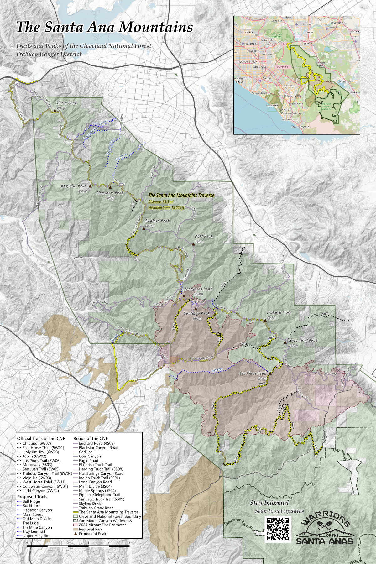
In a future newsletter, we’ll share more about the proposals, including the history behind these routes such as The Luge’s earlier life as the Morrow Trail. For now, you can view the proposed trails alongside the official CNF trail system and our BOLT-candidate route on this map.
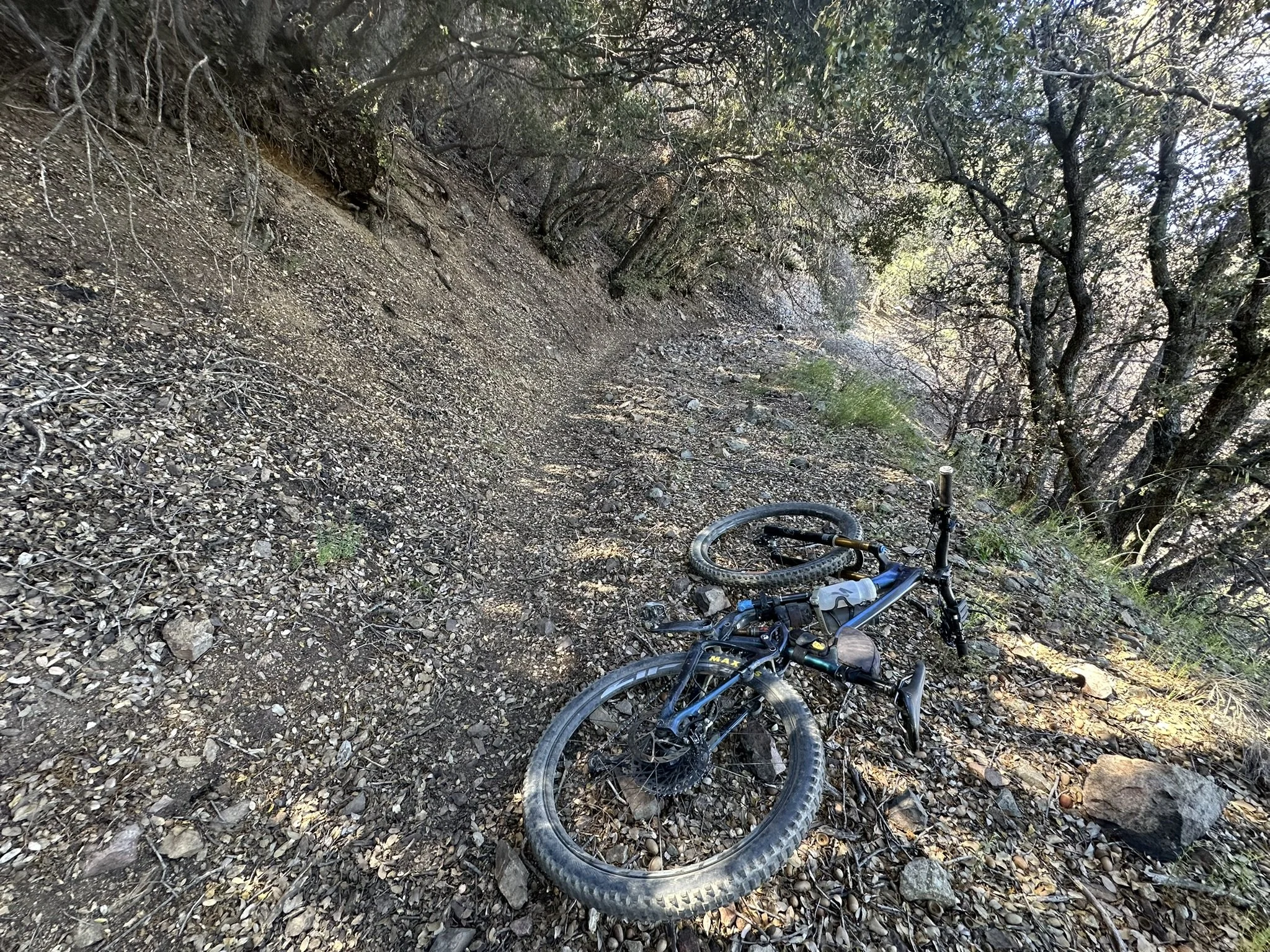
This is Buckthorn, one of our proposed trails. Come ride it with us on September 19.
Our CNF Trail Map Is Being Printed
Speaking of the map, about 20 people purchased this map as a 24” x 36” poster in our first print run—thank you! If you missed the order and would like to join a future run, let us know. We’ll likely do this again if there is enough interest. You can still view and download the map from our website.
Airport Fire Rehabilitation: The Straightforward Update
On Tuesday, September 8, Warriors of the Santa Anas met with Forest Service staff to discuss the San Juan Trail and the broader Airport Fire rehabilitation effort. The Forest Service now estimates that the required NEPA review will be completed in March 2027, rather than September 2026. Staff are exploring whether limited work on San Juan—such as brushing or work near the accessible ends of the trail—could be authorized sooner. The same review is required before restoration can begin on Joplin and the other Airport Fire-damaged trails.
We had hoped to make tangible progress sooner, but the fact remains: no rehabilitation work is currently authorized. We’ll let you know as soon as that changes.
We have not been idle. We’ve conducted several Forest Service-authorized trail assessments, engaged an experienced consultant with roughly four decades of Forest Service experience to strengthen our plans, interviewed four conservation corps, obtained quotes to understand cost and fit, and applied for a $50,000 grant to help fund the rebuild.
Forest Service staff know we are ready to help. Once we receive authorization, we will need your help too.
In the meantime, we can keep doing what is within our control: ride together, care for the places that are open, build strong partnerships, prepare for future work, and keep showing up.
That is what next week’s ride is about. We hope you’ll join us on the Modjeska/Motorway loop ride.
Roadless Rule Reminder: Submit Your Comment
The public comment period on the proposal to rescind the Forest Service’s Roadless Rule closes Monday, September 21, 2026. If you recreate in the Santa Ana Mountains and have not submitted a comment, there is still time to make your voice heard.
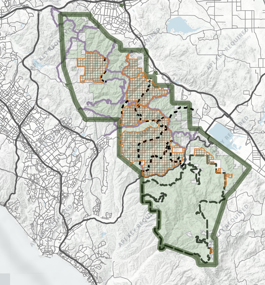
Roadless Areas within Cleveland National Forest, Trabuco Ranger District
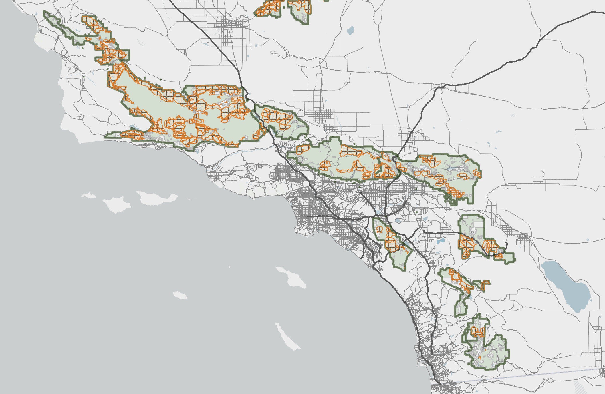
Roadless Areas within Southern California National Forests
